Atmospheric Resources Facilities
The Atmospheric Resources program facilities include an environmental wind tunnel, automated weather stations, and a mobile micrometeorology laboratory that has been used in inter-agency cooperative field experiments in California, Colorado, Pennsylvania, and New Mexico as well as Connecticut.
Other Atmospheric Resources equipment includes:
- portable elastic backscatter mini LIDAR
- sonic anemometers arrays
- hot film and cup anemometers
- computer-controlled data logging equipment
- solar arrays (PAR, IR, NET)
- UVB radiometers and weather sensors and more...
The Atmospheric Resources program also has a complete range of computational capabilities in addition to the University main frame facilities consisting of networked SUN and IBM RISC workstations and Pentium PCs.
Water Facilities
Aquatic Resources Laboratory
The Water Resources Aquatic Resources Laboratory contains state-of-the-art equipment for the measurement of most water quality constituents. Associated with the laboratory is a full range of field sampling equipment including ISCO automatic samplers and flow meters, rain gauges, Campbell Scientific data loggers and pressure transducers, current meters, and float-level recorders.
Terrestrial Resources Laboratory
The Water Resources Terrestrial Resources Laboratory is equipped for research in the areas of fate and transport of soil water and solutes and surface water hydrology. Computers dedicated to the mathematical modeling of chemical transport in porous media, hydrologic modeling, and GIS-related landscape analysis are located in the lab. Other equipment includes reflectometers, automated tensiometers, electronic probes, immuno-assay analysis, tension-infiltrometer, and disc permeameter.
The Institute of Water Resources (IWR)
The Institute of Water Resources promotes and supports programs relating to water quality, quantity, and use in Connecticut. Literature and newsletters from Connecticut lakes and watersheds are available on file, as well as technical completion reports of IWR-sponsored research and special publications. IWR maintains a laboratory for the identification of aquatic invertebrates for habitat analysis such as collecting equipment, chemicals, and microscopic equipment.
Water Resources Field Station and Ground Water Well Fields
The Department has three well fields on campus to conduct "hands-on" teaching and research on ground water resources and contamination in overburden and bedrock. In addition we have physical and chemical ground water laboratories in a newly refurbished Water Resources Field Station. The facilities include state-of-the-art water quality and hydraulic instrumentation to conduct ground water studies in the field.
Fisheries Facilities
The Fisheries Management program emphasizes both applied and basic research in fisheries management and ecology, focusing on the problems and opportunities facing fisheries management in the state and region.
The Fisheries Management program focuses on:
- Fisheries assessment in lentic and lotic systems
- Population and community dynamics
- Fisheries habitat
- Contaminants in fishes
- Species of special concern
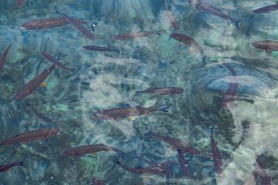
Fisheries Resources in Connecticut
Connecticut's aquatic resources are diverse and include marine, freshwater, anadromous, and catadromous fisheries. The Connecticut River supports popular striped bass, black bass, catfish, and shad fisheries. Smaller streams support both coldwater and warmwater fisheries. Warmwater and coolwater fish communities can be found in lakes and ponds throughout the state, and some coldwater fisheries exist. Long Island Sound supports important finfish and shellfish fisheries, both recreational and commercial.
Other Resources
- Connecticut Environmental Conditions Online (CT ECO) provides maps, guides and gisData.
- Geodesy Resources. According to NOAA, geodesy is the science of measuring and monitoring the size and shape of the Earth including its gravity field and determining the location of points on the Earth’s surface.
Ground Water Monitoring
- Water Resources Field Station
- Online Ground Water Monitoring Well WRFS-19
Station Information
- Well 19 is located at the Water Resources Field Station, on the campus of the University of Connecticut, Storrs, CT.
- Lat: 41° 48.928'N Long: 72° 14.377'W
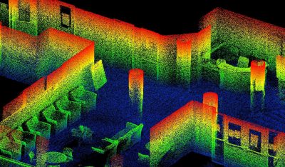
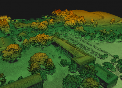
- The Laboratory for Earth Resources Information Systems (LERIS) at The University of Connecticut is a NASA Center of Excellence in Applications of Remote Sensing to Regional and Global Integrated Environmental Assessments.
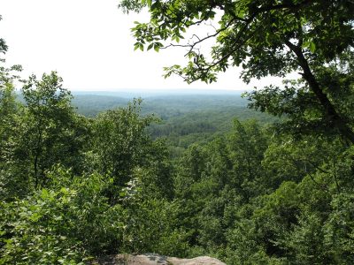
- The 580-acre Fenton Tract is the largest contiguous parcel of the UConn Forest.